Flash flooding leads to water rescues throughout Nashville, Middle Tennessee
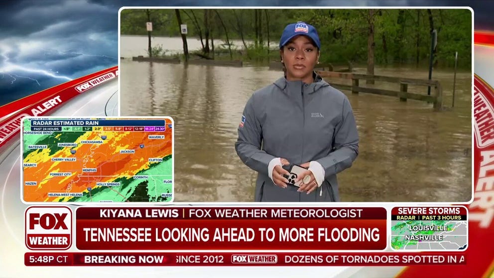
NASHVILLE – Much of Middle Tennessee is grappling with flash flooding triggered by a stalled weather pattern, which has led to repeated rounds of excessive rainfall.
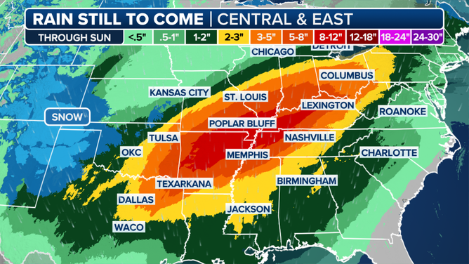
The central and western portions of the Volunteer State have been hit hardest, with some areas bracing for a foot of rain, and isolated locations expecting even higher totals into the early weekend.
The ongoing rainfall has created hazardous travel conditions, with life-threatening flash flooding becoming a growing concern across the region.
The Nashville Fire Department responded to over a dozen high water calls on Thursday with responders preparing for more water rescues in the days ahead.
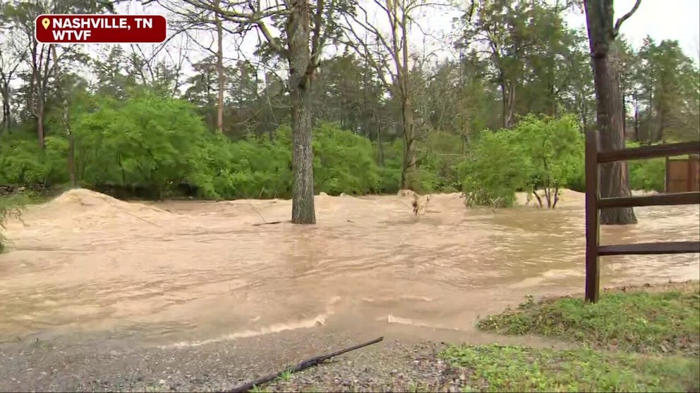
With the potential for once-in-a-lifetime rainfall and widespread impacts, “generational flooding” is possible across parts of the nation through Saturday, fueled by repeated rounds of storms that are already underway. Flooding was underway Thursday morning in Nashville, Tennessee. Cars were seen stuck in floodwaters in South Nashville in the early-morning hours. By daylight Thursday, neighborhoods were already inundated. The Trace Creek in the Bellevue neighborhood was well out of its banks.
Video from around the Music City showed businesses even being flooded by the heavy rainfall, but fortunately there have been no reported weather-related fatalities from Davidson County.
Governor Bill Lee issued an emergency declaration for 95 counties, and local authorities have issued warnings urging residents to stay vigilant over the next 72 hours due to potential weather-related impacts.
“Saturday is the day that concerns me the most right now,” said Meteorologist Ryan Husted with the National Weather Service in Nashville. “Because we have time for our atmosphere to recharge, which means we have the potential for dangerous severe thunderstorms once again. In addition, our ground is saturated — that means any rain that falls will run off and it’s going to cause flooding. I’m very confident in this that Saturday is a dangerous day for flash flooding going into Saturday night.”
WHY IS THIS RELENTLESS SEVERE WEATHER PATTERN STUCK OVER THE EASTERN HALF OF THE US?

Expected rainfall map
(FOX Weather)
The Tennessee Department of Transportation has closed numerous roadways due to floodwaters, a situation reminiscent of the catastrophic flooding seen during remnants of hurricanes.
TDOT officials also shared video from Carroll County, between Memphis and Nashville, where some state roadways were completely inundated by floodwaters.
Transportation officials said the advice to follow over the next couple of days is critical but rather simple: “Turn around, don’t drown.”
Flooding also impacted Interstates 40 and 50, but lanes remained opened, preventing the complete closure.
SEVERAL KILLED IN TORNADO OUTBREAK THAT HAS LEFT TOWNS SPLINTERED IN MISSISSIPPI VALLEY
The FOX Forecast Center said the weather pattern responsible for the ongoing rainfall is likely to persist through at least early Sunday.
By the end of the weekend, drier conditions are expected to move into the region, offering some relief from the torrential downpours and time to clean-up from the severe weather and the flooding.
Until then, the Tennessee Emergency Management Agency has urged people in flood zones to monitor for updates on weather and road conditions.
Nashville Police have also been stepping up their patrols, ensuring that people stay away from flooded rivers and streams.
Source link
editor's pick
latest video
Sports News To You
Subscribe to receive daily sports scores, hot takes, and breaking news!


